Best Hikes near San Jose Locals Recommend
From the sandstone canyon at Alum Rock to the summit crowds on Mission Peak, here's where San Jose actually goes to get outside, sorted by how much pain you're signing up for.
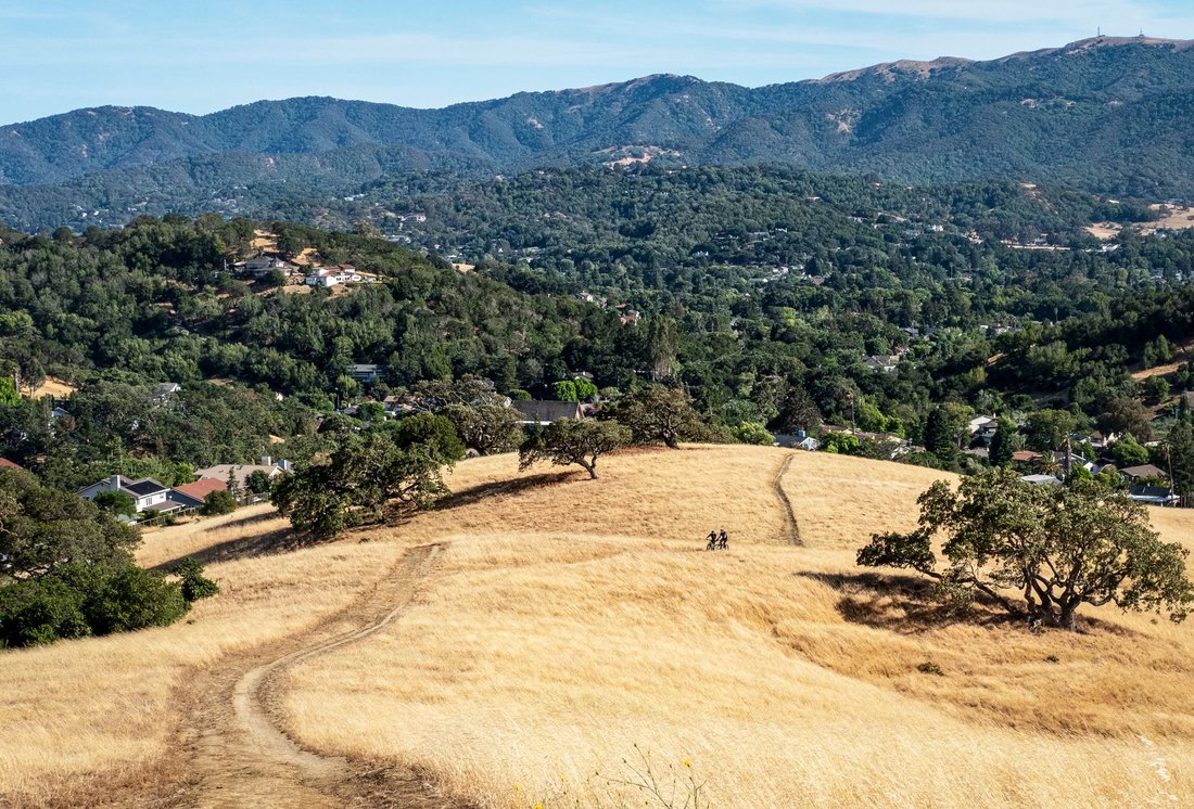
By seven on a Saturday, the lower lot at Alum Rock Park is already half full, and the people pulling in aren't tourists. They're the same neighbors you'd see at the Willow Glen farmers market, walking off a week at the office before the day gets hot. This is the thing outsiders miss about San Jose: the hills wrap around three sides of the city, and the best hikes near San Jose are the kind locals treat as routine, not a special occasion saved for out-of-town guests. The creek is running along Penitencia Creek Trail, the old mineral springs buildings sit quiet under the oaks, and somewhere up the canyon a group of regulars is doing the same loop they've done every weekend for a decade, coffee in hand, dog off leash where it's allowed. Some of these trails sit inside city limits. Others are a short drive into Santa Clara County's open space preserves, or over into Fremont and Morgan Hill, where the terrain gets bigger and the crowds thin out. What they have in common is that they're worked into daily life here, not saved for a special trip. This guide covers the range, from a flat evening stroll along a shaded creek to a full backcountry day that will leave your legs sore for a week. All of them are real trails that people in this city actually use, not a highlight reel assembled for someone flying in from out of town and wondering what San Jose even has to offer.
Best Hikes Near San Jose for a Quick, Easy Escape
These are the trails you do on a weeknight after work, with your parents visiting for the weekend, or when you just need forty-five minutes of trees and moving water without committing your whole day. Nobody treats these as a production. You just go.
Alum Rock Park
Alum Rock is the East Foothills park that a lot of San Jose kids grew up in, and it's easy to forget it's one of the oldest municipal parks in California. The canyon floor trail follows Penitencia Creek past the remains of the old mineral springs resort, under sycamores and oaks that keep the whole corridor shaded even in August. It's flat enough for a family outing or a first-date hike, but you can also branch onto steeper side trails that climb the canyon walls if you want more of a workout. The stonework and old bridges give it a different character than the grassland preserves further south, more built-up park than wild backcountry, and that's exactly the appeal. Go early on a weekend before the parking lot fills, because it does, fast, and locals know the quieter entrance is worth the extra few minutes of driving around. It sits on the city's east side, a short drive from downtown.

Rancho San Antonio Open Space Preserve
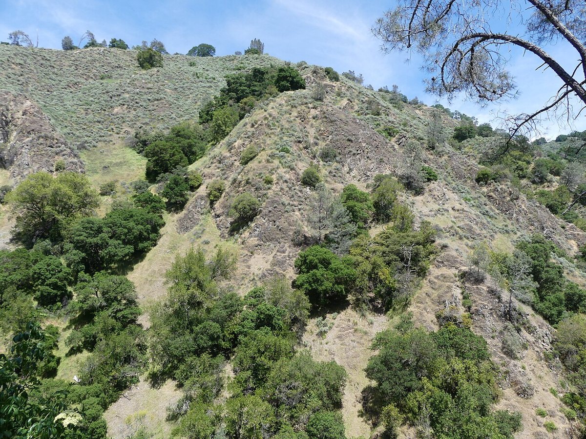
Rancho San Antonio, straddling the Cupertino and Los Altos hills, might be the single most popular trailhead in the South Bay, and once you've parked there on a Saturday morning you'll understand why the overflow lot exists. The wide, mostly flat trail out toward Deer Hollow Farm is stroller-friendly and packed with families, dog walkers, and trail runners squeezing in a lunch break. Keep going past the farm and the grade tips upward toward Black Mountain, turning a mellow outing into something with real climbing if you want it. What makes it worth the drive from San Jose is the working farm itself, still raising animals for school groups, and the view back down over the valley floor once you've gained some elevation. Weekday mornings are calm. Weekend afternoons are a scene, cars parked along the road well before you reach the actual lot. It's northwest of San Jose, close enough to the 280 corridor to be an easy add-on to a Saturday errand run.
Fremont Older Open Space Preserve
Fremont Older, above Cupertino, gets overlooked next to its bigger neighbors, which is a mistake because the view from Hunters Point is one of the better payoffs for the least amount of effort anywhere in the region. The climb up is short and the grassy hilltop opens onto a wide look across the valley, especially good in that window after winter rain when the hills are green instead of their usual gold-brown. Beyond the main loop, the preserve has quieter trails through oak woodland that barely see foot traffic even on busy weekends, which makes it a good pick if Rancho San Antonio's parking lot has already defeated you. It's compact enough to knock out before work if you're an early riser. Located west of San Jose near Saratoga, it's an easy tack-on if you're already headed toward the hills on that side of the valley.


Moderate Hikes Near San Jose Worth the Climb
This tier asks more of your legs and your morning. Expect real elevation gain, longer time on trail, and views that make you stop talking for a minute.
Sierra Vista Open Space Preserve
Sierra Vista sits above the Eastside, in the hills off Quimby Road, and it delivers one of the widest panoramas of San Jose you'll find anywhere, the whole valley floor laid out from the airport to the Santa Cruz Mountains on a clear day. The climb to the ridge has some sustained grade to it, enough that you'll feel it, but it's not a technical or exposed trail. What locals like about it is that it's still underused relative to how good the view is, since it doesn't get the tourist traffic that Mission Peak pulls. Wildflowers show up on the open slopes in season, and hawks work the thermals along the ridge most afternoons. Go in the late afternoon toward sunset if you want the light on the valley to do something special, just bring a headlamp for the walk back down. It's a straight shot east from downtown San Jose, closer than most people expect, and it's the one a lot of Eastside residents treat as their default after-work climb rather than a weekend event.

Almaden Quicksilver County Park
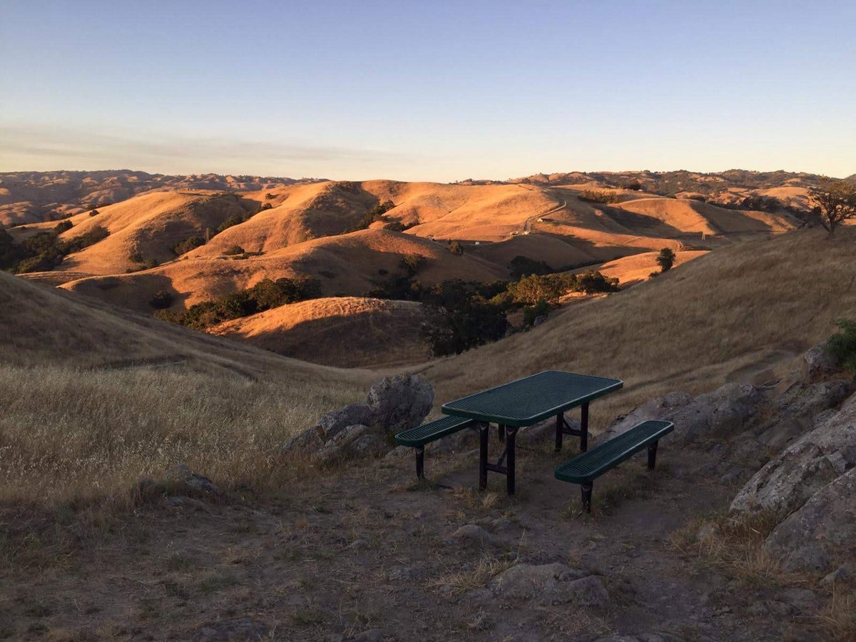
Quicksilver, down in the Almaden Valley on San Jose's south side, is built on the site of a former mercury mine, and the old kiln remains and mine shaft openings scattered through the park give it a history that most open space land around here doesn't have. It's a big park with a network of trails that range from rolling fire roads to steeper singletrack, so you can build a short loop or turn it into a half-day out-and-back depending on how you feel. The chaparral cover means limited shade through the middle of the park, so this is not the one to do at noon in July. Spring is when it's at its best, with wildflowers along the grassy slopes and enough runoff that the reservoirs actually have water in them. It's a favorite among Almaden Valley locals for a reason: you can be on a real trail ten minutes from a neighborhood street. Bring more water than you think you'll need and check trail conditions if it's been a dry stretch, since some of the connector trails get dusty and exposed by midsummer.

Sanborn County Park
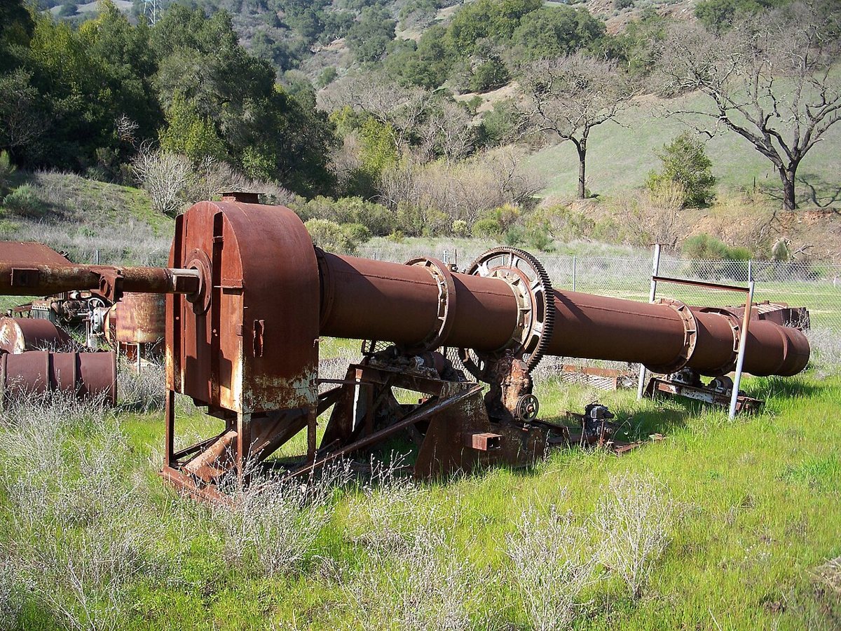
Sanborn sits in the redwoods above Saratoga, which makes it the closest thing San Jose has to a Santa Cruz Mountains hike without actually driving to Santa Cruz. The shift from oak grassland to redwood canyon happens fast as you climb, and the temperature drops with it, which is exactly what you want on a hot valley day. Trails here connect toward Castle Rock and the ridge above, so ambitious hikers can turn a Sanborn visit into a much longer day if the legs are willing. The park also runs a campground and has historic buildings near the entrance, giving it a different, more forested feel than the grassland preserves closer to the valley floor. Go on a weekday if you can. Weekend mornings pull a steady crowd of Saratoga and West San Jose regulars who know exactly how much cooler it is up there, and campers staying overnight tend to have the trails mostly to themselves once the day crowd clears out.
Santa Teresa County Park
Santa Teresa covers a long stretch of hills on San Jose's south side, above the Santa Teresa and Blossom Valley neighborhoods, and it's the rare park in the area with enough trail mileage that regulars can do a different loop every week without repeating themselves. The ridgeline trails offer views west across the valley and east toward the Diablo Range, and the rolling, grassy terrain has a different character than the oak-shaded parks closer to the foothills, more open sky, more wind. It's popular with mountain bikers as well as hikers, so stay aware on the multi-use trails, especially on weekends. Because it's tucked against a residential edge of the city, it's an easy one to treat as a regular training ground rather than a special trip, which is exactly how a lot of South San Jose hikers use it. Morning fog sometimes sits in the valley below while the ridge stays clear, which makes for a strange and pretty effect if you time it right.

Ed R. Levin County Park
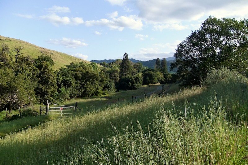
Ed R. Levin sits in the hills above Milpitas, right at the north end of the valley, and it's best known locally as a launch site for hang gliders and paragliders off Monument Peak, which makes for a good show if you're on the ridge at the right time. The trail up climbs steadily through grassland with wide views back over the northern part of the valley and the Bay itself on clear days. It connects into the larger trail system that eventually links toward Mission Peak, so if you're feeling ambitious you can turn a Levin hike into something much bigger. Closer to the entrance, there's a golf course and picnic areas that keep it family-friendly at the base, even as the upper trails get serious. It's a solid pick when you want elevation and a view of the Bay without driving all the way to Fremont, and it draws a noticeably calmer crowd than Mission Peak even though the view rivals it on a clear day.

Strenuous Hikes and Backcountry Near San Jose
These are the trails that require an early start, real water, and a legitimate level of fitness. They're also the ones people talk about for years afterward.
Mission Peak Regional Preserve
Mission Peak, above Fremont, is the one out-of-towners have usually heard of, mostly from photos of hikers lined up at the metal pole marking the summit. It earns the reputation. The climb from the main Stanford Avenue staging area is steep and mostly exposed the whole way, no real shade cover, which turns it brutal on a warm afternoon and genuinely dangerous if you're not carrying enough water. The payoff at the top is a 360-degree view that takes in the entire South Bay, the Bay itself, and on a clear day the ridgelines all the way out to the coast. It is heavily used, especially on weekends, to the point where the staging area lot fills early and rangers manage overflow parking. Locals who do it regularly go at sunrise, both to beat the heat and to have a shot at the summit without a crowd around the pole. It's technically in Fremont, a straightforward drive north from San Jose along the east side of the Bay, but enough South Bay hikers make the trip that it counts as part of the regional rotation rather than an out-of-town errand.

Joseph D. Grant County Park
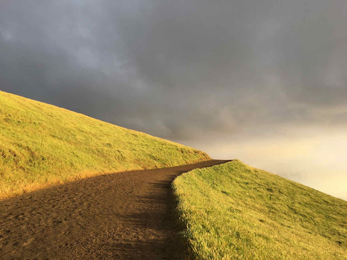
Grant Ranch, out past Alum Rock on Mount Hamilton Road, is the biggest county park in Santa Clara County and it feels like it, rolling oak savanna and grassland that stretches for miles with barely another hiker in sight once you're a mile or two in. This is where you go when Rancho San Antonio's crowds have worn you out and you just want quiet. The terrain rolls rather than climbs straight up, but the distances add up fast, so plan a real route before you head out rather than winging it. Cattle still graze parts of the park, a reminder that this land was ranchland long before it was open space, and the lake near the entrance draws waterfowl worth slowing down for. It gets hot and shadeless in summer, so this is a cool-season or early-morning park more than anything else. It's east of the city on the road up toward Lick Observatory, far enough out that it feels like a genuine departure from San Jose, and the drive itself, winding up through the foothills, is part of the appeal.

Uvas Canyon County Park
Uvas Canyon, down near Morgan Hill on the southern edge of the county, is the waterfall hike locals save for the rainy season, when the creek network running through the park actually has enough flow to make the falls worth the drive. The Waterfall Loop climbs through a shaded canyon of oak and bay laurel, with several distinct cascades along the way, and it's a genuinely different landscape than anything closer to downtown San Jose, steeper-sided, damper, more intimate. Outside of the wet months the falls thin out considerably, so this is one where timing matters more than almost anywhere else on this list. It's far enough south that it takes a real drive to get there, past Morgan Hill and up into the canyon, which keeps the crowds thinner than the closer-in parks even on a good rain year. Bring layers. The canyon holds cold air even when the valley floor is warm, even on the same afternoon that Santa Clara Valley is baking down below.

Henry W. Coe State Park
Coe is in a different category from everything else on this list, and locals who hike it regularly will tell you that in the first sentence. It's the largest state park in Northern California, a genuine backcountry landscape of ridges and canyons east of Morgan Hill, and the frontcountry trails near park headquarters barely hint at how much terrain is back there. A short loop near the visitor center works fine for an introduction, but the park rewards people willing to plan a longer day or an overnight backpacking trip into the interior, where the crowds thin to almost nothing. Water sources in the backcountry can't be counted on, especially late in the dry season, so anyone heading past the frontcountry trails needs to plan carefully and check current conditions before committing. Spring is when Coe is most forgiving, with wildflower displays across the ridges and creeks still running. It sits east of Morgan Hill, a longer drive from San Jose than anything else on this list, and that distance is part of why it stays wild. Rangers at the visitor center are worth talking to before you set out, since they know current water and trail conditions better than any map.

Practical Notes for Hiking Near San Jose
A few things that matter more here than the guidebooks tend to admit.
- Spring is the best all-around season. The hills are green, wildflowers are out on the grassland trails, and creeks and waterfalls actually have water in them. By late summer, most of these hills have gone gold-brown and dry.
- Heat is the real hazard, not elevation. Many of these trails, especially Mission Peak, Grant Ranch, and Almaden Quicksilver, have long stretches with no shade. Carry more water than you think you need and start early in summer, not midday.
- Dogs are welcome on leash at most of these county and city parks, though rules vary by preserve, so check current regulations before you bring one along, especially at parks that share trails with grazing cattle.
- Parking fills fast at the popular spots, Rancho San Antonio and Mission Peak above all, on weekend mornings. Arriving by eight, or picking a weekday, saves the headache of circling for a spot.
- Check current hours, seasonal closures, and parking fees before you go, since these change park to park and season to season.
- Layer up for the parks with real elevation or canyon shade, like Sanborn and Uvas Canyon, where the temperature can shift noticeably between the trailhead and the top.
- Cell service drops out in stretches at the bigger, more remote parks, Henry Coe especially, so let someone know your route and expected return time before heading into the backcountry.
The Best Hikes Near San Jose Aren't a Secret, They're Routine
None of this is undiscovered territory. These are the trails San Jose actually uses, the ones filling up parking lots at seven on a Saturday morning with people who live ten minutes away, not visitors chasing a photo. That's sort of the point. A city this size, with hills wrapping three sides of it, doesn't need to borrow its outdoor identity from anywhere else. After a morning on one of these trails, a plate of something from one of the taco spots around town tends to be the correct next move, and if you're building out a longer weekend, there's a wider list of things to do in San Jose worth working through. Get out early, carry water, and treat these hills the way the rest of us do: as the backyard, not the destination.